I only managed to get out for an hour on Sunday, so I walked around the wetlands. We have had a lot of rain recently so I was keen to see what the water levels are like. The first channel wads really full, so I started taking photos trying to remember where I'd taken them in the heat of last summer for comparison. After a while I realised I had taken all scenic shots, and no birds, (a first for me!!) So here they are, preceded by a screen capture courtesy of google maps, showing the location and direction of each shot.

Shot 1 shows my house, (Red roof with the silver Subaru Forester parked on the road), taken from the entry way to the park.

The next two show the first part of the outer path (2) and the closest water channel (3).


The areas closest to my house have been planted with indigenous trees that are still to reach maturity (4). There are two paths that cross the park, making a shorter loop possible. (5).


To the east is the largest feeder pond, (6) and (7), and this was the first time I had seen water flowing into the wetlands here.


The park is well used by locals, and I always see joggers (8) and dog-walkers here. The Eastern side is bordered by some agricultural holdings including an olive orchard (9)


The northern path goes through more mature woodland (10) and holds a number of smaller ponds (11) and the main wetland area (12) which held water for the first time this winter.


As you head around the wetland and turn towards the South-east, the path runs along a raised embankment, parallel to a main road (13), and you get views into the centre of the park (14).


The inner paths are not so wide, as they get less use (15). Finally it's time to turn back eastwards towards home. This is the path I use each day to get to the bus stop for work (16) which takes me behind the old folks home (17)


Hopefully this has given you a taste of the wetland park close to my home.

 As we continued north, the skies cleared and the desert was blooming.
 The drive to Alice Springs takes two days to complete comfortably (allowing for birding along the way)and the highway is long, straight and can be very boring.
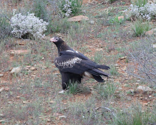
 We saw lots of raptors along the way, with more Wedge-tailed Eagles and some Brown Falcons posing nicely in trees along the verge.

 We were soon in new territory, which comes with the added benefit of new birds. We stopped at a few spots, including one just short of the Northern Territory border where I saw a Bourke's Parrot, a real icon of the red centre. In the drier areas, our common Superb Fairywren is replaced by White-winged Fairywren. I didn't manage a shot of the stunning male, but this is the first time I have photographed the female.

 Carrying on to "the Alice", the weather deteriorated again, and we finally arrived after dark, in persistent drizzle, looking forward to new birds in the morning!!


